Ridgecrest and the Local Areas in the IWV
Ridgecrest
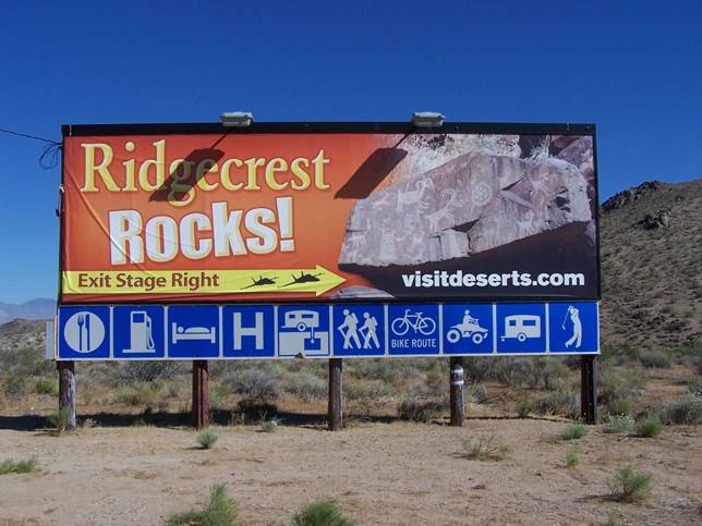
Ridgecrest is a city in Kern County, California, United States. It is located along U.S. Route 395 in the Indian Wells Valley in northeastern Kern County, adjacent to the Naval Air Weapons Station China Lake (NAWS, or China Lake). The population was 27,616 at the 2010 census, up from 24,927 at the 2000 census. The city of Ridgecrest is a largely "company" oriented community big enough to provide plenty of schools, shopping and health care. It was incorporated as a city in 1963.
Ridgecrest is surrounded by four mountain ranges; the Sierra Nevada on the west, the Cosos on the north, the Argus Range on the east, and the El Paso Mountains on the south. It is approximately 82 miles (132 km) from the Lancaster/Palmdale area and approximately 145 miles (233 km) from both Bakersfield and San Bernardino, the three nearest major urban centers. Private air travel in and out of the city is provided through the Inyokern Airport. There are currently no scheduled commercial flights in or out of Ridgecrest.
Ridgecrest is within two hours of the highest and the lowest points in the conterminous U.S.
The settlement began as a farming community called Crumville in 1912, honoring James and Robert Crum, local dairymen. The first post office opened in 1941. By 1943, Ridgecrest had grown to 115 homes and 196 residents. NOTS (Naval Ordnance Test Station) was established in November 1943, providing a strong job base for the years to come.
Ridgecrest incorporated in 1963. During this era the growth of Ridgecrest was governed by the continuing needs of the high tech industries coupled to the Naval Station's programs for testing arms and guidance systems.
Ridgecrest | Inyokern | Randsburg | Trona | Red Rock Canyon | Mileage Chart | Back to Top
Inyokern
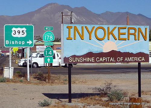
Inyokern (formerly, Siding 16 and Magnolia) is a census-designated place (CDP) in Kern County, California, United States. Inyokern is located 8 miles (13 km) west of Ridgecrest, at an elevation of 2434 feet (742 m). It is on the western side of the Indian Wells Valley. The population was 1,099 at the 2010 census, up from 984 at the 2000 census. It was a railroad town established along the Southern Pacific railroad Lone Pine Branch (now removed). It is served by Inyokern Airport.
Inyokern is located at 35° 38'49 N 117° 48'45 W. It lies in Indian Wells Valley, with the eastern slopes of the Sierra Nevada rising to the west.
It is on U.S. Route 395, the main north-south artery, connecting the Inland Empire to Reno, Nevada. US 395 also connects Inyokern to Los Angeles via State Route 14 through Palmdale.
State Route 178, the main east-west artery, connects Inyokern to Bakersfield, the county seat, via Lake Isabella in the west, and to Death Valley via Ridgecrest in the east.
According to the United States Census Bureau, the CDP has a total area of 10.9 square miles (28 km2), over 99% of it land.
Ridgecrest | Inyokern | Randsburg | Trona | Red Rock Canyon | Mileage Chart | Back to Top
Randsburg
Randsburg (formerly, Rand Camp) is a census-designated place (CDP) in Kern County, California, United States. Randsburg is located 17 miles (27 km) south of Ridgecrest, at an elevation of 3504 feet (1068 m). The population was 69 at the 2010 census, down from 77 at the 2000 census.
Randsburg is located at 35° 22'07 N 117° 39'29 W. It is on the west side of U.S. Route 395 between Kramer Junction to the south and Ridgecrest to the north. Randsburg is in the Rand Mountains, and is separated by a ridge from the neighboring community of Johannesburg.
According to the United States Census Bureau, the CDP has a total area of 1.945 square miles (5.038 km2), over 99% of it land.
Gold was discovered at Rand Mine near the site in 1895 and a mining camp quickly formed, and was named Rand Camp, both mine and camp were named after the gold mining region in South Africa. The first post office at Randsburg opened in 1896.
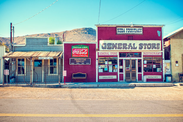
The town has an influx of tourism throughout the year, mainly from fall through spring. Travelers stop in while driving Highway 395, or camping in the area and off roading. During Thanksgiving, as well as New Year's Day weekend, the town is flooded by tourists. Many come on motorcycles and other off-road vehicles that line the streets. The center for most tourists is the general store/ice cream parlor. Famous for their 1904 soda fountain and "Black Bart" banana split dessert, the general store still sells food, necessities, and antiques from the area. The town has antique stores, art galleries, gift shops, a mining museum, and an old jail open to tourists. The Randsburg General Store is open every day except Wednesday. The museum and all other businesses, including the town's two watering holes, are open on the weekends.
Ridgecrest | Inyokern | Randsburg | Trona | Red Rock Canyon | Mileage Chart | Back to Top
Trona
Trona is an unincorporated community in San Bernardino County, California. In 2000 it had a population of 2,742. Trona is at the western edge of Searles Lake, a dry lake bed in Searles Valley, southwest of Death Valley. The town takes its name from the mineral trona, abundant in the lakebed. It is about 170 miles (274 km) northeast of Los Angeles, on State Route 178. The ZIP code is 93562.
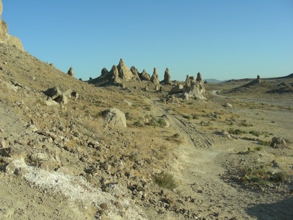
Trona is known for its isolation and desolation, as well as the nearby Trona Pinnacles. The local school plays on a dirt football field because the searing heat and highly saline soil kills grass. At one point it boasted an 18 hole golf course that was all sand except for the "greens", which were a softer grade of brown colored dirt.
Starting in the late 1800s mining industry set up around Searles Dry Lake to mine borax.
Trona was officially established in 1913, as a self-contained company town, wholly operated by its resident mining company to house employees. Employees were paid in company scrip instead of cash. The mining company also built a library, a scrip-accepting for-profit grocery store, a school, basic housing, and minimal recreation facilities. The Trona Railway was built in 1913–14 to provide the town with a rail connection to the Southern Pacific (now the Union Pacific) line at Searles. The railway still operates today.
Economic booms and busts followed. Its most notable boom occurred during World War I, when Trona was the only reliable American source of potash, an important element used in the production of gunpowder.
Today, Searles Valley Minerals Inc.'s soda ash processing plant remains the largest firm in town. Other operations nearby include evaporative salt extraction from the dry lake bed's surface, and a lime quarry. Searles Valley Minerals is the largest employer in Trona, and many employees live in Ridgecrest, California, commuting daily to Trona.
Trona also serves as the headquarters and base of operations for the Trona Railway, a short-line railroad.
Trona High School has 162 students and competes as the Tornadoes. It has the only dirt American football field in the United States. (Barrow High School in Alaska previously had a dirt field, but it was replaced with blue Astroturf in 2007.
A number of films have been shot in the surrounding desert (particularly around the Trona Pinnacles), including Star Trek V: The Final Frontier and Planet of the Apes. In the 2000s, the town itself served as the setting for three films, Trona (2005), Just Add Water (2008) and Lost Lake (2012).
Ridgecrest | Inyokern | Randsburg | Trona | Red Rock Canyon | Mileage Chart | Back to Top
Red Rock Canyon
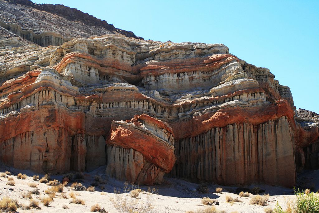
Red Rock Canyon features scenic desert cliffs, buttes and spectacular rock formations. The park is located where the southernmost tip of the Sierra Nevada converges with the El Paso Mountains.
Each tributary canyon is unique, with vivid colors. After wet winters, the park's floral displays are notable. Wildlife includes roadrunners, hawks, lizards, mice and squirrels.
Red Rock Canyon is an approximately 27,000 acres (110 km2) unit within the Mojave Sector of the Tehachapi District of the California State Park System, located along State Highway 14 in Kern County, about 80 miles (129 km) east of Bakersfield and 25 miles (40 km) north of Mojave. Red Rock Canyon provides magnificent views of the pristine desert landscape, includes two natural preserves, and offers, among other recreation activities, camping, sightseeing, equestrian activities, hiking, and opportunities for reflection and solitude.
The park is located on State Route 14, which connects U.S. Route 395 with the communities of Southern California, where 14 is known as the Antelope Valley Freeway. The park is 25 miles (40 km) northeast of Mojave on SR 14. SR 14 goes through the center of the park, in the canyon itself. No motorist/tourist facilities are available. It is not far from Cantil, California. Camping, picnic, and restroom facilities are available in several sites immediately off of California Route 14.
Ridgecrest | Inyokern | Randsburg | Trona | Red Rock Canyon | Mileage Chart | Back to Top
Mileage Chart
| Ridgecrest, Ca to... | Miles | Km | Dir |
| Bakersfield, Ca | 112.1 | 180.4 | SW |
| Barstow, Ca | 82.9 | 133.4 | SE |
| Bishop, Ca | 136.7 | 219.9 | N |
| Cal City, Ca | 49.3 | 79.3 | SW |
| Death Valley National Park | 113.4 | 182.5 | NE |
| Inyokern, Ca | 10.2 | 16.4 | W |
| Lancaster, Ca | 84.2 | 135.5 | SW |
| Las Vegas, Nv | 237.6 | 382.3 | E |
| Los Angeles, Ca | 154.0 | 247.9 | S |
| Mammoth Lakes, Ca | 178.9 | 288.0 | N |
| Mojave, Ca | 57.8 | 93.0 | SW |
| Palmdale, Ca | 92.4 | 148.7 | SW |
| Randsburg, Ca | 21.0 | 33.9 | S |
| Red Rock Canyon National Park | 36.2 | 58.2 | SW |
| San Diego, Ca | 224.2 | 360.9 | S |
| San Francisco, Ca | 394.5 | 634.9 | NW |
| Seattle, Wa | 1044.4 | 1680.9 | N |
| Trona, Ca | 24.0 | 38.6 | NE |
| Victorville, Ca | 86.5 | 139.2 | S |
| Yosemite National Park | 275.4 | 443.3 | NW |
| Yuma, Az | 336.9 | 542.2 | SE |
Ridgecrest | Inyokern | Randsburg | Trona | Red Rock Canyon | Mileage Chart | Back to Top